By Sören Fürbas, Project Manager for Drone Services, airsight GmbH
Using drone-based technology for a PCN study.
While most air traffic users including airports are spending efforts in restricting drone activities near airports, some operators are researching new opportunities to make their lives easier by the usage of such new technologies. The airport operator of lux-Airport for example started the implementation of UAV-based pavement inspections, using the new technology to their advantage.
For publication in the AIP, the Pavement Classification Number (PCN) must be determined, which is conventionally done through a classical pavement evaluation, requiring multiple inspections and taking a lot of time. At lux-Airport, all aprons have been surveyed and assessed using a novel concept, taking advantage of a combination of proven, established methods and supplementing these with a drone-aided aerial survey and thus saving a lot of time and effort.
Reiko Schroeder, Chief Operating Officer, airsight GmbH: “As for all UAV operations at airports, the main success of the mission depends on the early engagement with the main stakeholders, notably air traffic control (ATC) and the responsible aviation authorities.”
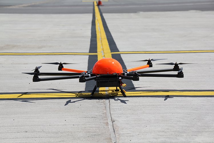
An unmanned aerial system equipped with a high-resolution digital camera
airsight deployed a team of two aeronautical engineers, trained to fly UAVs, to perform this aerial survey. They used an unmanned aerial system equipped with a high-resolution digital camera on around 50 individual flight segments with a duration of 10 to 12 minutes each. To warrant the safety of flight operations, the drone inspections took place in close coordination with authorities and air traffic control.
The camera photographed a total area of 430,000sqm, which was then processed into orthophotos with a resolution of 3mm per pixel. During each flight segment, 300 to 500 raw images were captured for post-processing and, with the help of photogrammetry software, single image files were stitched into a rectified and undistorted overall image.
Based on the orthophotos, the engineers conducted a visual distress analysis to derive the paved surface condition and assess the damage percentage. Homogeneous (surface condition) areas were identified based on pre-defined distress categories. The visual inspection provided valuable input data for the remaining steps of the PCN determination and brought the airport operator time and cost savings.
Alexander Flassak, Director Finance & Real Estate, lux-Airport: “The UAV-based pavement inspections were a great success: we could assess and document our entire 8 aprons in record time and with a great level of detail. The results serve as basis for all pavement maintenance activities for the years to come. The inspections were very well coordinated with ATC and airport operations and had minimal impact on operations. We would recommend this type of service to airports that require a systematic, efficient and traceable documentation of their pavement condition.”
Visual inspections can reduce the number of necessary core drillings
The project team evaluated the surface condition further by performing falling weight deflectometer tests on all aprons with a grand total of around 1,500 measurements. Based on the homogenous areas created by the visual inspections it was decided where to perform additional core drillings and laboratory tests to get an inside view of the pavement structure.
Considering the results from all campaigns, the PCN values were calculated for different life spans taking into account traffic forecasts, aircraft types and loads. Finally, airsight created a comprehensive overview of all aircraft stands, possible aircraft types and associated ACN and the local PCN value to enable the airport operator to optimise stand allocation and pavement life spans on his aprons.