In this article, Florian Guillermet, Executive Director, SESAR Joint Undertaking, describes the safety-net solution for vehicle drivers and how it is helping airports with very different operational environments ensure safety and in doing so maintain capacity in all weather conditions.

Florian Guillermet, Executive Director of the SESAR Joint Undertaking.
Driving a vehicle around the airport should be straightforward in normal operational conditions. But how do you ensure you are following the correct route in dense fog or at night? And more importantly, how do you ensure that you are not entering a safety critical area without a clearance, or crossing traffic, putting you and the aircraft at risk? SESAR, the EU’s flagship project for modernising air traffic management, has developed a system to increase the situational awareness of vehicle drivers and reduce the risks of area infringement and collision with aircraft.
Today, vehicle drivers rely on procedures based on the “see and avoid” principle to get around the airport safely. Some airports may require vehicle drivers to request clearance from air traffic control when entering a manoeuvring area, but this is not always the case. What is more, drivers do not currently have tools aboard to detect if they have entered a restricted area or are endangering aircraft.
These conventional visual-based procedures work well when the drivers have good visibility of the runways and taxiways, but they are less effective at night or in foggy and low-visibility conditions. To ensure safety in situations like these, vehicle drivers have to determine their position on the airfield by recognising the name and the position of the taxiways and runways. Given the increase in traffic, the complexity of airport layouts and the increasing number of operations that take place in low visibility conditions, vehicle drivers need more advanced capabilities to ensure their safe and efficient movement around the airport.
SESAR has now delivered a system to improve the driver’s situational awareness and to issue alerts in situations where there is a risk of collision or infringement in a restricted or closed area. Developed in accordance with the European ATM Master Plan, the system can be installed as a separate physical display in the vehicle or as an integrated application, and has several innovative functionalities. One of these is the airport moving map, which allows drivers to determine the actual position of their vehicle on the airport surface, indicating the layout of the airport and geographical features in close proximity to the vehicle.
 SESAR Solution Catalogue
The SESAR Solution Catalogue provides an overview of the new or improved operational procedures or technologies so far delivered by SESAR to modernise the European and global ATM system. Each solution includes a range of documentation, including technical specifications, safety, performance and interoperability requirements, as well as regulatory recommendations, and human and environmental performance reports. The first edition of SESAR Solutions catalogue contains 63 Solutions, of which 24 are being deployed across Europe simultaneously (Pilot Common Project).
The map’s visualisation capabilities offer vehicle drivers with an unprecedented display of all the surrounding traffic such as aircraft, towed aircraft and other vehicles. It can even go further to distinguish between arrival and departure aircraft using different colours or symbols, and has a zoom functionality so that drivers can also get a closer look at the traffic. Because the map is updated in real time, drivers can get the very latest status of the manoeuvring area and more specifically restricted or closed areas.
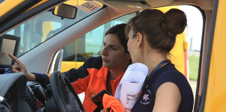
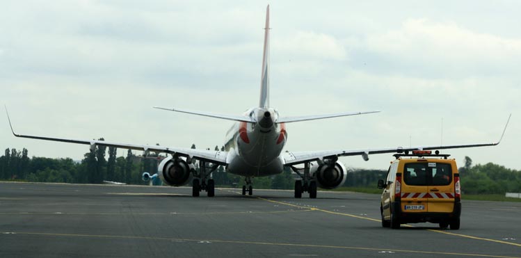
SESAR has now delivered a system to improve the driver’s situational awareness and to issue alerts in situations where there is a risk of collision or infringement in a restricted or closed area. Copyright: Groupe ADP
Perhaps the most important functionality of the SESAR Solution is the sophisticated alert system that drivers now have at their fingertips. Alerts are based on pre-set algorithms within the system that measure the speed and heading (trajectory) of the vehicle and its relative position and projected trajectory to other aircraft and restricted areas or active runway zones. In all weather conditions, but especially in adverse weather conditions, vehicle drivers may have difficulties in finding their way and knowing their exact position on the manoeuvring area. An alert is triggered when a potential risk for an area infringement or a collision with an aircraft is imminent. There are several types of alerts and local procedures to respond to alerts, depending on how imminent the dangerous situation may be. Given that drivers should not take their eyes off the road, alerts are given both aurally as well as visually.
With its four runways, Paris Charles de Gaulle has a huge surface area of tarmac to manage, catering for 470,000 movements annually. To maintain runway capacity safely, the airport has already seen the equipage within some 250 vehicles of a surveillance system, which provides controllers with the position of equipped vehicles every second. Copyright: Groupe ADP
Safety comes first, which is why SESAR Solutions undergo intensive tests in real operational environments. The vehicle drivers system was first assessed in a simulated environment using the Stockholm Arlanda Airport layout by drivers themselves. The drivers involved found the alerts were effective in identifying potential risks, while the moving map significantly improved their situational awareness.
SESAR then went further by taking the solution out of the laboratory with a series of live trials in Dublin and Paris Charles de Gaulle, two airports with very different characteristics and operational needs. Dublin Airport is among Europe’s fastest growing airports, reporting a record 190,000 movements in 2015. But given its proximity to the coast, the airport often has to deal with very foggy and low-visibility conditions, which can hamper the arrival and departure of traffic. The layout of the airport also means that vehicle drivers are obliged to regularly cross runways, thereby leading to higher risks of runway incursions. With its four runways, Paris Charles de Gaulle has a huge surface area of tarmac to manage, catering for 470,000 movements annually. To maintain runway capacity safely, the airport has already seen the equipage within some 250 vehicles of a surveillance system, which provides controllers with the position of equipped vehicles every second.
During the Dublin trials, the SESAR team validated alerts using a centralised implementation of the alert system, meaning that the alerts were generated in a ground server and uplinked to the vehicles for display to the drivers. In the case of Paris, the alerts were directly generated onboard the vehicles. In both set of trials, participating vehicle drivers found that all the tested traffic alerts were useful. They noted that level of nuisance and false alerts, while recognising the need for its reduction, did not impact their situational awareness. Most importantly, the trials showed that with the use of the SESAR Solution the safety level of vehicles operating in the manoeuvring area increased. The trials provided SESAR with some important recommendations on the ergonomic design of the system, procedures to follow when alerts are triggered, as well as the technologies that are needed to enable the system, and training that will be required for vehicle drivers to use the system. In SESAR 2020, the next wave of ATM research and innovation, the plan is to address other guidance enhancement tools for vehicle drivers and further refine the map of the solution. Work is underway now to finalise all the reference material on this SESAR Solution in order to make it publically available for download via the SESAR JU website by airports interested in implementing the system. Some airports are already making a start, such as at Paris Charles de Gaulle where deployment of this SESAR Solution is foreseen by winter 2018.
Find out more about this solution in the SESAR Solution Catalogue: www.sesarju.eu
Note: The SESAR Solution was validated with the support of the following SESAR members and partners: DSNA, Groupe ADP, NORACON (Swedavia, IAA and EANS) as well as SEAC (Zurich Airport).